


The remote sensing of greenhouse gases is not a new field, stationary sensors have been used as far back as 1815 to detect methane in coal mines. However this device was used only a few feet away from the source, while satellites, such as GHGSat’s Claire, orbit at an altitude around 500 km. This larger detection range creates many flexibilities, such as allowing satellites to cover a larger area than a typical sensor. Together these sensors create a full greenhouse gas sensing ecosystem (see our blog post Satellite Based Methane Emissions Monitoring for more information on methane sensing specifically). In this post we will dive deeper into the bottom up vs. top down approach to remote sensing, the benefit and limitations of each, and how each technology serves a purpose.
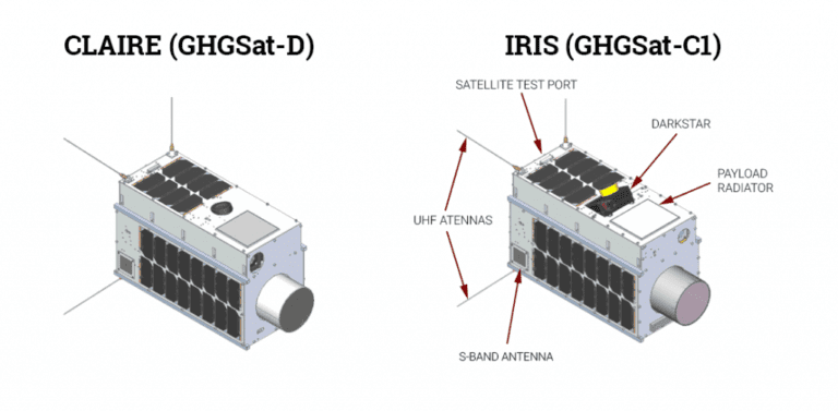
At the physical top of our greenhouse gas sensing ecosystem lies the satellites. Remote sensing satellites orbit hundreds of kilometers above Earth’s surface, some of which are able to cover the world in just one day. Revolutionizing the gas sensing industry, there are only a handful of satellites currently detecting greenhouse gases, although several more are on their way. GHGSat, for example, currently has two remote sensing satellites in orbit, Claire and Iris, with a third, Hugo, preparing for launch next month. GHGSat has already changed the satellite field by their upgraded pixel resolution, to 50 m, which compared to the 7,000 m resolution of TROPOMI is outstanding. This improved resolution will allow leak sources to be pinpointed more precisely, a characteristic usually given to a bottom up sensor.
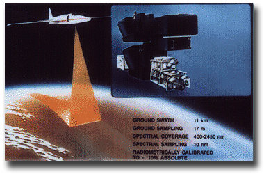
The most notable greenhouse gas detecting aircraft is NASA’s AVIRIS, which coasted at an altitude of 18km. First taking off in 1989, AVIRIS has been around for some time, but is currently not supporting any active missions. Jet fuel limits aircraft in comparison to satellites. AVIRIS typically takes 6.5 hour flights that comprise two week long missions. That being said, AVIRIS recorded many important data, and not just limited to greenhouse gases, it also recorded ecological, geological, atmospheric, environmental, and many other types of data.
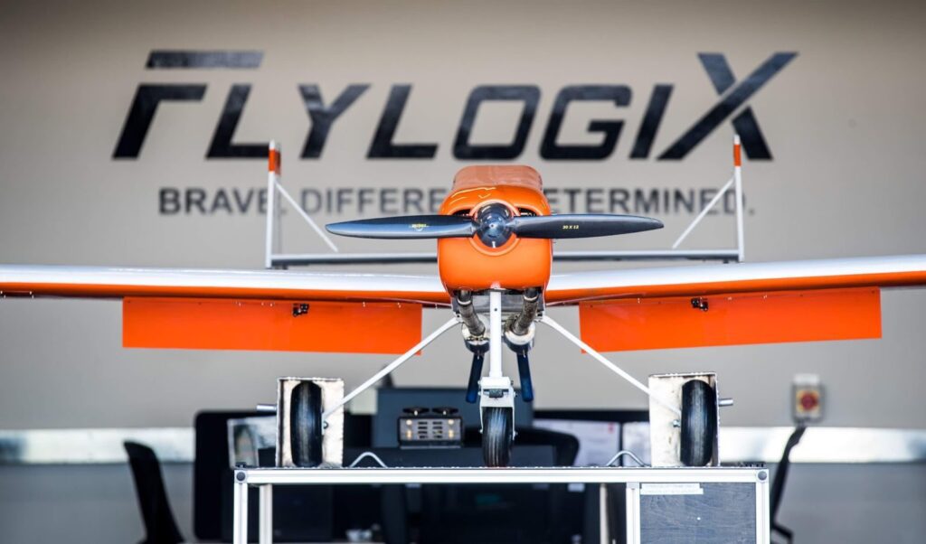
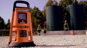
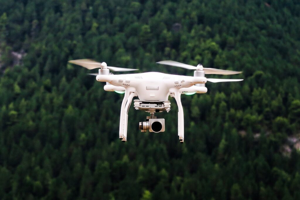
Next to satellites on the up and coming greenhouse gas sensing devices would be drones. Drones provide the user full control, yet complete safety and ease of not having to be nearby. FlyLogix, a drone carrier, recently installed a new methane sensor created by SeekOps, that can detect methane leaks from 3-300ft away. The high sensitivity is an upside of drones, some are able to record just 1 ppm of greenhouse gases, such as methane.
Satellites provide the ease of once they are in orbit, they do not need much work and provide a steady stream of accurate data all over the globe. On the other hand, drones can be brought to the exact place of interest and detect any leaks in question. The size of the satellite dataset is a powerful tool, it can be used to analyze greenhouse gas emissions of the entire world, an asset relatively new to humankind, and being utilized on our Greenhouse Gas Dashboard. Currently, the best satellite pixel resolution is 50 m, which can be recorded 500 km from the area of interest. This resolution is being worked on as we speak, but is incomparable to the drone sensors, able to sense 1 ppm. Both values are extremely impressive and show the updates in technology all around us. They also reflect the individual roles these top down technologies fulfill, and how they are unlikely to be replaced anytime soon.
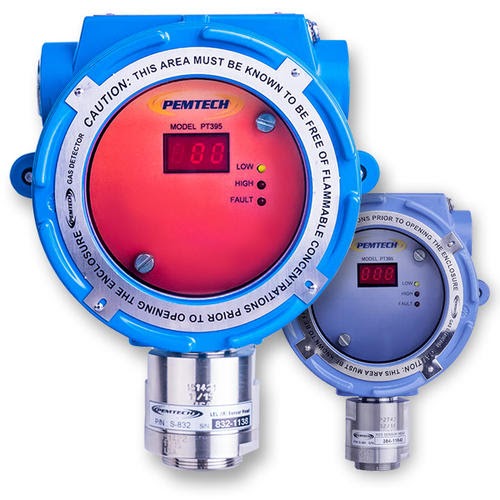
Stationary sensors are typically positioned in a place and kept there for long periods of time. They are helpful around production sites that may encounter a leak, and these sensors are able to detect gas levels at any time of day, setting off an alarm to notify the appropriate personnelle.
In contrast to stationary sensors, mobile products move with the user, with the ultimate goal of keeping the human safe. The original mobile sensors were canaries, which coal miners used for decades starting in 1911. The bird’s rapid breathing rate and high metabolism made them quick victims to carbon monoxide, and thus a great detection device for miners. Other animals have been used to detect gas leaks, such as rabbits, honey bees, molluscs, and pigeons, but technology has successfully and safely replaced them. A unique type of mobile sensor is an imaging sensor. FLIR is a leader in gas detecting cameras. The user of these cameras takes an image or video of the designated area, and the gas levels appear on the image as a spectrum of color.
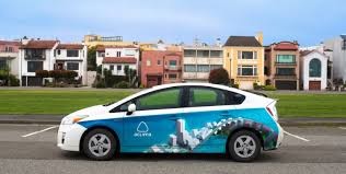
Another type of mobile sensor is the auto category, which consists of a car fashioned with sensors. The car collects data on its route and maps the air quality of the surrounding areas. A benefit of this method of data collection is that cars have the size and strength to carry multiple instruments that can detect not only greenhouse gas levels, but also air contaminants. The speed of the car gives it the ability to cover more ground than a typical mobile sensor, yet it is not nearly as fast as remote sensing satellites.
The precision of bottom up sensors is spectacular, and most likely the proper route for a user looking for safety features in a possible gas leak zone. However, they only cover the area in near proximity, maybe up to a few dozen meters. This shortcoming makes them the wrong device to collect large amounts of data, which would require thousands of sensors to be placed around the world.
Each of the discussed greenhouse gas sensing devices has a common goal, to accurately report greenhouse gas levels. Some are more concerned with immediate detection and safety, while others have a long term goal. Regardless, the remote sensing ecosystem is complete only with each and every one of them. It relies on the large swath of satellites and aircrafts to report the information top down, and the accuracy and precision of ground level sensors from the bottom up.
We use cookies to improve your experience on our site. By using our site, you consent to cookies.
Manage your cookie preferences below:
Essential cookies enable basic functions and are necessary for the proper function of the website.
These cookies are needed for adding comments on this website.
Statistics cookies collect information anonymously. This information helps us understand how visitors use our website.
Google Analytics is a powerful tool that tracks and analyzes website traffic for informed marketing decisions.
Service URL: policies.google.com
Marketing cookies are used to follow visitors to websites. The intention is to show ads that are relevant and engaging to the individual user.
LinkedIn Insight is a web analytics service that tracks and reports website traffic.
Service URL: www.linkedin.com
 Optimized by Seraphinite Accelerator